
by Alex Storvick, Washington Puget SoundCorps and Aquatic Reserves Program
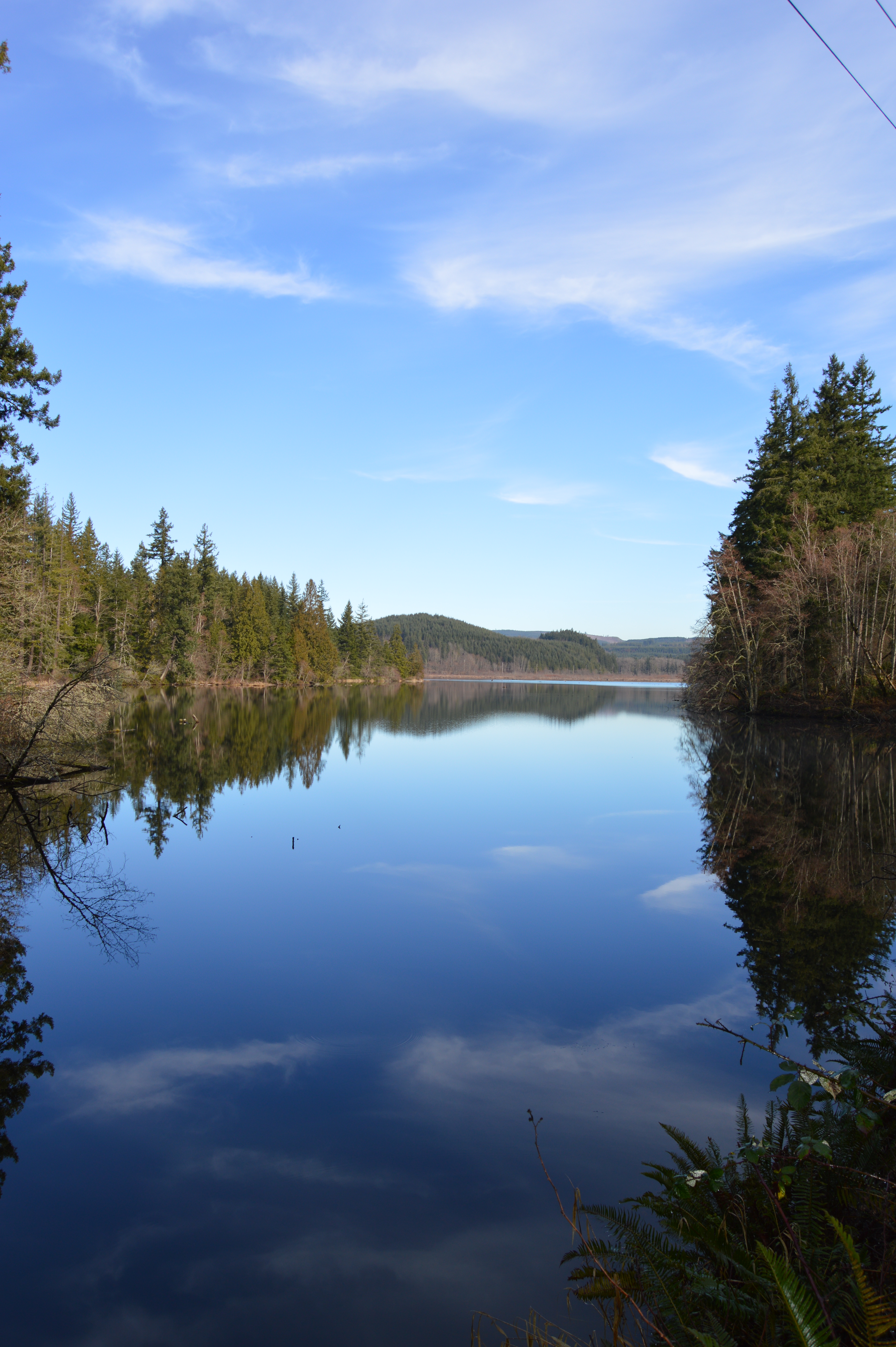
Lake Kapowsin may become Washington State’s first freshwater aquatic reserve.
The Washington State Department of Natural Resources is considering designating Lake Kapowsin as the state’s first freshwater aquatic reserve because of its unique geologic origins, natural habitats, and relatively undeveloped shorelines.
Around 1503, Mt. Rainier unleashed the Electron Mudflow. This lahar, a river of mud, began on the western slopes of the mountain, taking with it trees as big as three meters in diameter, and swept down the Puyallup River to the Puget Sound. The rock in this area suffers from structural weaknesses as snow and ice interact with hot rocks, which may have caused the lahar. The process dammed the Kapowsin tributary and created the lake we see today.
Settlers began trickling into the area in the 1880’s. Fred Hilgert and his wife are credited with establishing the first homestead on Lake Kapowsin. This was short-lived, as a railroad was built through their backyard and forced their move away from the shoreline. Lumber mills popped up along Kapowsin’s shorelands and the lake was used as a log pond. Employment steadied and expanded, the population grew, and by 1910 the town of Kapowsin was bustling. The lakeshore was home to workers and their families, and supported businesses and schools. Seattle and Tacoma used connecting railways to bring lumber from Kapowsin for building expansion. By the 1920’s and 30’s, however, the timber boom town of Kapowsin gave way to mill fires and Tacoma’s unrealized reservoir plans.
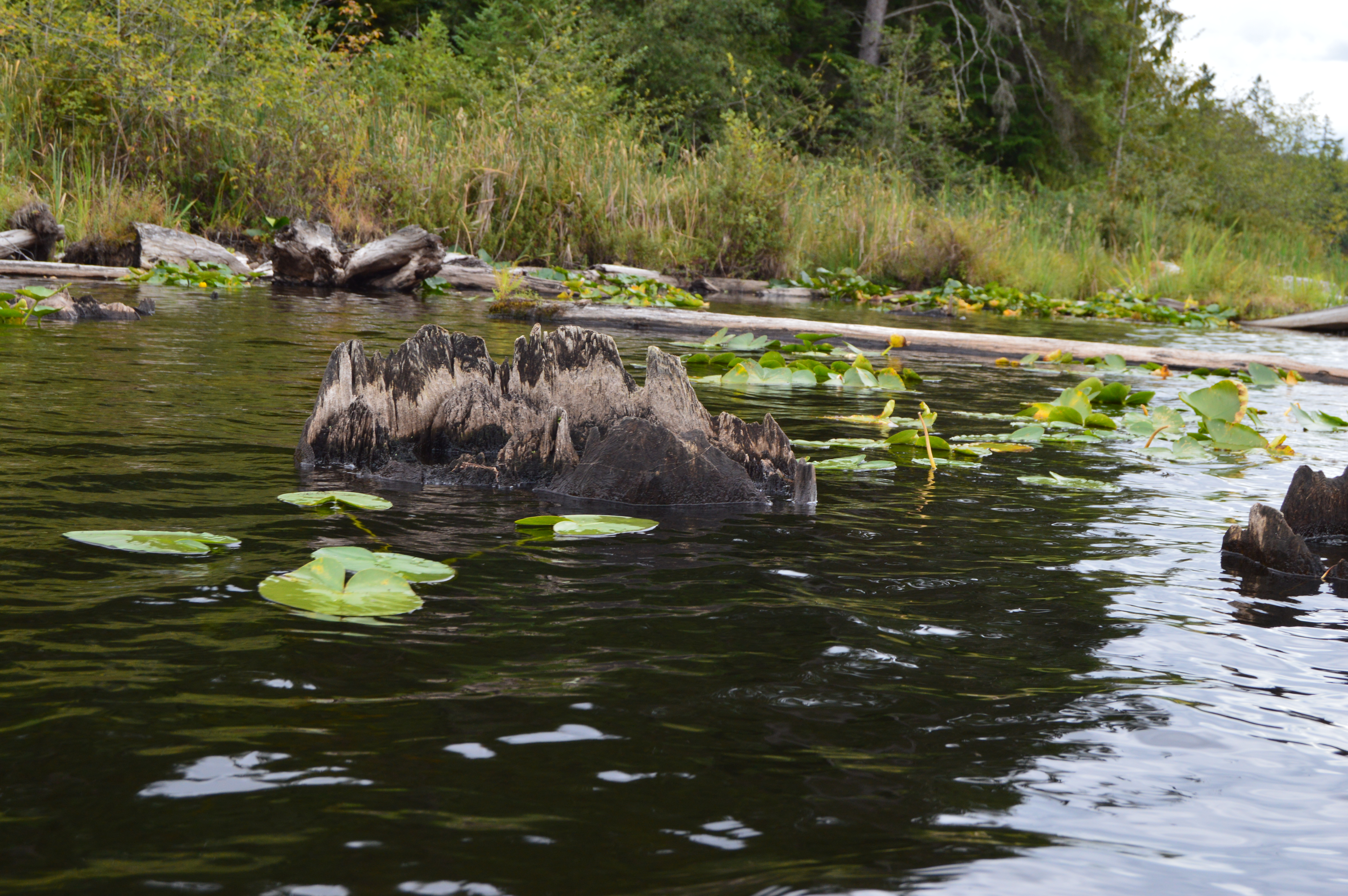
Submerged stumps supply intricate and complex habitat where fish can hide and spawn.
Today the 512-acre Lake Kapowsin preserves the remains of a mature old growth forest, and thus contains evidence for dating the historic lahar. It provides a fascinating example of recent geology, and valuable ecological features as well. Submerged stumps supply intricate and complex habitat where fish can hide and spawn. Waterfowl use emergent stumps for nesting sites. Intact forest cover surrounds the lake, providing shade and cover, and there is a breathtaking view to the east.
Past scientific research in the area focused on tree ring carbon dating. Well-known USGS geologist Dwight Crandell (who died in 2009) used radiocarbon dating to estimate that the Electron mudflow occurred nearly 500 years ago. Centralia College geology professor Patrick Pringle (who was with USGS at the time) narrowed the date to 1502-03 using cores pulled from stumps buried in the historic lahar sediment layers. A grant secured by one of Pringle’s students will allow additional sampling and analyzing of submerged tree cores at Kapowsin to continue in 2015.
The Puget SoundCorps (part of the Washington Conservation Corps administered by the Department of Ecology) conducts ongoing research at the lake, including water quality monitoring and amphibian surveys. Water quality monitoring is currently limited to turbidity, temperature, and dissolved oxygen (DO). Three sites are visited monthly; one each at the inlet and outlet, as well as a third in the center. Site depth is measured, with temperature and DO measured at meter increments.
From a canoe along DNR-managed shorelines, SoundCorps members do surveys for eight stillwater amphibian species, including the Northwest salamander, Pacific tree frog, American bullfrog, and Northern red-legged frog. DNR also has a contract with Hamer Environmental to carry out additional biological inventory, including wetland surveys, macro-invertebrate sampling, and water and sediment analysis.
DNR’s Aquatic Reserves Program ensures environmental protection of these lands through preservation, restoration and enhancement activities, and adaptive management practices. DNR held two open houses on the proposed reserve this fall, at which local citizens expressed interest in protecting the natural features of the lake, organizing trash clean-ups, and continued public access for hunting and fishing.
The reserve establishment process involves review by a technical advisory committee (TAC). Members of the committee (who include Patrick Pringle) have expertise in a variety of areas including wetlands, geology, fish biology, and lake ecology. The committee has reviewed the proposal for Lake Kapowsin and submitted recommendations for the site to DNR. With DNR management approval, the reserve program will work with the community to develop a management plan for the unique state-owned aquatic lands at Lake Kapowsin.
Sources
Anderson, Lawrence D. In the Shadow of the Mountain: Early Days of Graham, Kapowsin, Benston, Electron, and Vicinity. Graham: L.D. Anderson, 2007.
Dawes, Ralph L. and Dawes, Cheryl D. “Geology of the Pacific Northwest: Virtual Field Site—Enumclaw Area.” WVC Commons. Wenatchee Valley College. 17 July 2013. 30 April 2015. http://commons.wvc.edu/rdawes/VirtualFieldSites/Enumclaw/VFSEnumclaw.html
Pinkser, Lisa M. “Paths of Destruction: The Hidden Threat at Mount Rainier.” Geotimes. American Geological Institute. April 2004. 30 April 2015. http://www.geotimes.org/apr04/feature_MountRainier.html