by Katy Pfannenstein, MS Environmental Science candidate, Western Washington University
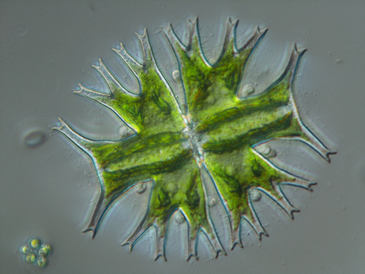
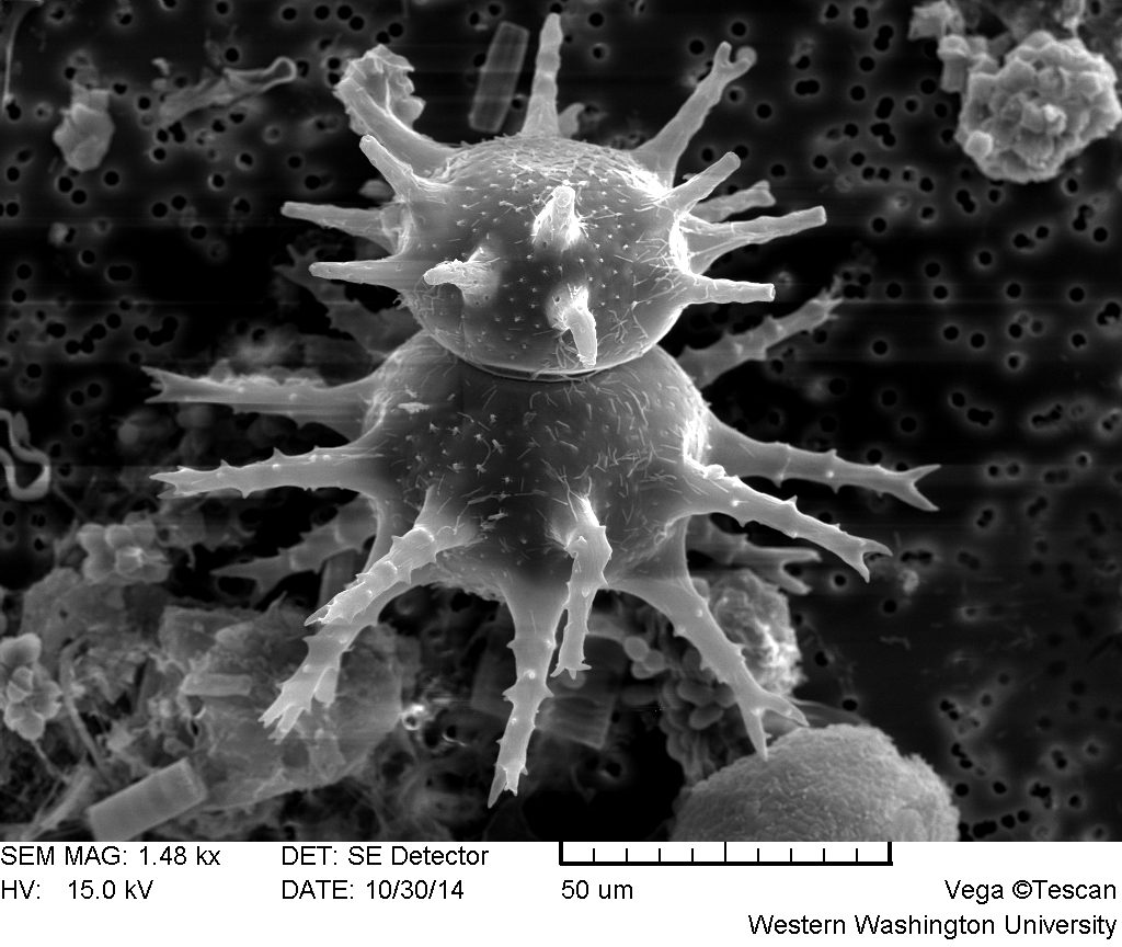
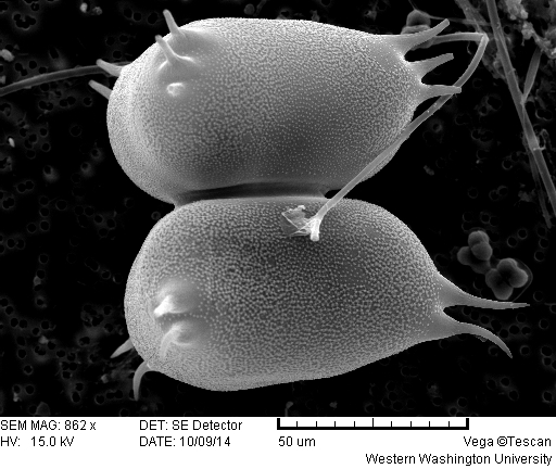
Micrasterias furcata
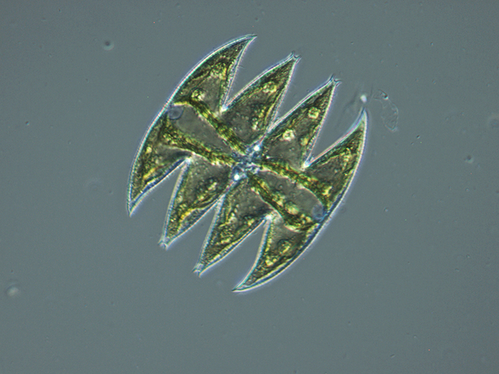
Micrasterias laticeps
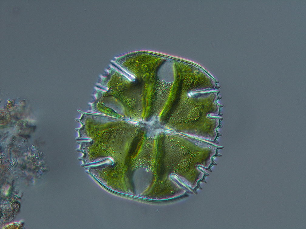
Micrasterias truncata – Micrasterias photos by Dr. Robin Matthews
Mountain lakes are characterized as small, low-productivity aquatic systems that have a short ice-off season. They are generally protected from direct human impacts, but are poorly buffered and sensitive to atmospheric deposition and global climate change. Phytoplankton, which are free-floating, microscopic, photosynthetic organisms, can be powerful biological indicators of freshwater ecosystems. Each species of phytoplankton has different physiological requirements and varies in its response to physical and chemical parameters like light, temperature and nutrient regime. Phytoplankton are well adapted to their environments, but can be very sensitive to environmental changes such as increased nutrient loading and chemical stressors. As global temperatures increase and seasonal precipitation fluctuates, algae should be good indicators of climate change, especially in mountain environments.
At Western Washington University, where I am finishing my Master’s degree, I am studying water quality and algae diversity of ten mountain lakes along the Mountain Loop Highway in Washington. The main objectives of my research are to: (1) collect water quality and watershed data from the ten lakes and describe the similarities and dissimilarities between individual lakes or groups of lakes, (2) characterize the taxonomic diversity and relative abundance of algae, and (3) determine whether the water quality and watershed data are related to the taxonomic diversity and relative abundance of the algae in the ten lakes.
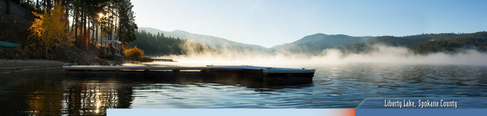
Located in the Mount Baker-Snoqualmie National Forest, the Mountain Loop Highway is a popular destination for hiking, fishing, bird watching, mountain climbing and skiing. Snowy weather and icy road conditions make access to the Mountain Loop Highway area challenging, which has resulted in a lack of water quality data for the region. The ten lakes in my study — Bear, Boardman, Coal, Evan, Goat, Heather, Independence, Island, Myrtle and Twentytwo — are accessible only by hiking trails. I chose them for my research based on historical sampling data, geographical proximity and accessibility.

Collecting water quality and watershed data at Coal Lake
In the summer of 2014, I headed into the mountains with my undergraduate assistants, equipped with hundreds of sampling bottles. In July and August, we sampled each lake in three locations with a telescoping pole from shore. The following water quality parameters were analyzed: temperature, dissolved oxygen, conductivity, turbidity, pH, chlorophyll, alkalinity, total nitrogen, nitrate+nitrite, total phosphorous, soluble reactive phosphorous, silica, chloride, sulfate, total and dissolved organic carbon, as well as total and dissolved values for sodium, magnesium, aluminum, potassium, calcium, manganese, iron, nickel, copper, zinc, arsenic, antimony and barium. We collected live, concentrated algae samples with a plankton net and whole water samples for enumeration and biovolume calculations.
Staurastrum arctiscon
Staurastrum longispinum

Xanthidium antilopaeum v polymazum
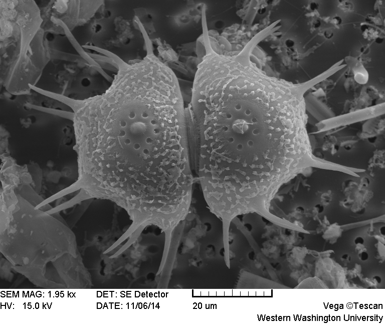
Xanthidium Cristatum
Photos by Katy Pfannenstein.
Initial water quality assessment grouped lakes based on mesotrophic/oligotrophic trophic states, a possible bedrock influence and high/low organic carbon content. Multivariate statistical analysis revealed that the spatial and temporal variation had little effect on within lake similarity, meaning that while there were slight differences between July and August water quality results, each lake was more like itself than the other lakes for both months. Multivariate analysis also showed that the ten lakes formed two distinct groups, influenced by high and low dissolved organic carbon concentrations, as well as a few other variables such as high/low dissolved aluminum, dissolved zinc and sulfate concentrations.
Working together, Dr. Robin Matthews, Karl Bruun at the Nostoca Algae Laboratory and I identified 405 species of algae within all of the lakes. This is a conservative number, as more algae were identified outside the July-August sampling period that were not included in my study. Of the 405 total species, 258 were unique to just one lake. For example, Myrtle Lake contained 104 total identified species, and had 51 unique species, meaning that half of the algae species found in Myrtle were only found in Myrtle! Overall, desmids dominated the type of algae found, with 136 species. Diatoms were second, with 97 species found. No significant patterns were found when we statistically analyzed the lakes with regard to algae cell counts and biovolumes. However, when separated by the high/low organic carbon groups, desmids, green algae and blue-green algae had statistically higher cell counts and biovolumes for the high organic carbon lakes.
To summarize, the ten lakes in my study had strong and predictable groups that formed with the water quality data. The lack of grouping with the algae data showed that each lake was unique and had extremely diverse algae populations. Lakes with similar water quality characteristics favor similar types of algae, such as desmids, but host different species compositions. This study has also provided baseline water quality and algae data to track changes and trends over time. Desmids, which are cold water specialists typically found in boggy lakes, will not tolerate warmer temperatures and could be used as bioindicators for the changing climate.